
PART 1: 140,000,000 BC - 30,000 BC
Little is known about Kunak, a little town in the east-coast of Sabah. Yet evidence of ancient human activities dated back to around 30,000 BC had been found by some archaeologists in the area. An article in the book, South East Asia: From Prehistory to History by Glover & Bellwood (2004), mentioned of "an unusual industry of chert bifaces of possible Late Pleistocene age in the Tingkayu area.
The District of Kunak covers an area of 1144 square kilometers and consists of two mukims namely Mukim Madai and Mukim Pangi. It is situated at 4o 40’ 60 N; 118o 15’ 0 E.
This part of eastern Sabah is said to have appeared above the surface of the sea during the Cretaceous period (140 million to 65 million years ago) although the island of Borneo really begin to push its way out of the sea about 15 million years ago. Thus, the large limestone massifs of Sabah are mainly found on the east coast. One such formation is the Madai Cave in Kunak.
During the Pleistocene period about 2.5 million years ago, Borneo, Java, Sumatra, Celebes and Peninsula Malaysia were all joined together, along with many smaller islands and they formed a continent known as Sundaland. At times when the sea level was low they were all connected to mainland Asia and it would have been possible to walk from here to Ireland without crossing sea. This ancient land bridge had the effect of enriching the flora and fauna of Borneo. The seas rose again separating Sundaland, leaving Borneo to evolve separately.

During the Miocene period, 10 to 15 million years ago, a large mass of molten rock intruded beneath the marine sediments that were eventually to form the Crocker Range of mountains. Mount Kinabalu (4010 m) was formed just over a million years ago when the cooled and hardened molten rock forced its way upward from beneath the earth’s surface. The island of Borneo found its present coast line only about 10,000 years ago as the gigantic blocks of ice formed during the last ice age melted away and raised the sea level.
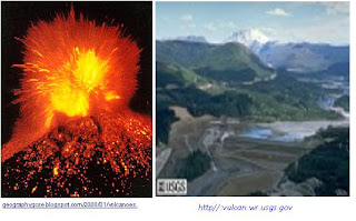
Back at the east coast in Kunak, around 30,000 BC, Mount Mostyn erupted. The lava flow blocked part of the Tingkayu River forming a lake. Many years after the molten rock cooled down, the bank of the lake and its surrounding became so fertile and flourished with tropical plants. Soon, bountiful animals congregated to the site to forage young shoots and slurp on the crystal clear water of the lake. It became a first-class hunting ground.
Meanwhile the men put up fire, gathered some flat hard stones and started to pound on them. They were making tools for hunting.


No comments:
Post a Comment