Showing posts with label Kunak. Show all posts

Friday, June 12, 2009

ON TRAIL OF THE HISTORY OF KUNAK - PART 6

Thousands of stone tools had been excavated from Madai caves. The tools were mostly made from local river pebble chert, of an industry similar to that of Baturong. Mortars that were used by the prehistoric people of Madai for grinding food, cracking shells or ochre preparations were also found.

The presence of abundant shells in Madai Caves indicates that the inhabitants frequented the shores to gather seafood from the beaches. Hunting of animals continued. The hunted animals include large animals such as seladang and two species of rhinoceros, i.e., javanese rhinoceros (Rhinoceros sondaicus) and sumatran rhinoceros (Rhinoceros sumatrensis). Today, javanese rhino no longer exists in Sabah.

Around 5,000 BC the Madai Caves were abandoned. There are no detail studies yet to determine the reason for the inhabitants to leave or where they had gone.

However, with their skill in manufacturing many types of stone tools for any particular purpose, the Madai Tribe must had tools for cutting trees and woods. With the warmer climate, they did not need the caves for shelters against the cold nights. Human nature to continue in search of comfort and wellbeing had driven the tribe to move closer to the easy source of food. They had found easy source of food from the beaches that assure them that their family need not go through hunger anymore at times when the hunters returned home empty-handed.

Obviously, there were no reasons for the Madai Tribe to continue living and sharing the damp, dark caves with bats and swiftlets. They were fed up with the thickening guanos on the cave floor. Thus, the tribe left the cave and moved out closer to the beaches.

With their skill in manufacturing stone tools for any particular purpose, they had no problem in making tools specially for cutting trees and woods. They began to build shelters from small timbers, barks, vines, rattans, and palm leaves. Hence, in 5000 BC the foundation of kampongs began in the District of Kunak, Sabah.

Wednesday, May 27, 2009

KUNAK DISTRICT LEVEL OF KAAMATAN CELEBRATION

A physio-therapist from Hospital Kunak, Victoria Yam, 24, was crowned as "Miss Unduk Ngadau of Kunak 2009". She was among six finalists who participated in the beauty pageant (click to view video) in conjunction with the Kunak District Level Kaamatan Festival held at Kampong Kadazan on 23rd May 2009. The runner-up position went to Kimberly C. Fay, 20, while second runner-up went to Aflin Joseph, 21.  
   Kunak State Aseemblyman, Nilwan Kabang who officiate the opening ceremony said that he is very happy to see other ethnic communities beside the Kadazan-Dusun ethnic, attending and participating in programs held in conjunction with the celebration. He added that their (the other ethnic communities) participation will enhance mutual respect and cooperation among the multiracial people of Kunak.
   Nilwan called on the people of Kunak to comprehend and put into action the Kaamatan Celebration theme, Together We Mould a Better Future, by being more tolerant, cooperative, and helping one another.
    Meanwhile, in his welcome address the chairman of the organizer, Valentine R. Sebastian appealed to Nilwan and Kunak District Officer, Susilo Sumarto to help in getting Kampong Kadazan gazetted in the near future. According to Valentine, Kampong Kadazan occupied an area of 4.5 acres within the land title of Mostyn Estates. It was allocated by the original land title owner, British Abaca Limited (BAL) Plantations in 1958 to the families of its employees from the Kadazan-Dusun ethnic. At that time BAL Plantations also allocated two other areas namely Kampong Selamat to the Cocos ethnic and Cooperative (now Kampong Sri Bahagia) to Bugis and Chinese ethnics. The land title had since changed hands twice, from BAL Plantations to Golden Hope Plantations and finally under the current owner Sime Darby Plantations Berhad.

Also present were Kunak District Officer, Susilo Sumarto and his two assistants, the People Development Head of Department (PKR), Halid Harun and his staff as well as other dignitaries of Kunak.


Sunday, May 24, 2009

PRODUCT OF KUNAK - GIANT CASSAVA CRACKER

If you are a tourist or a traveler who use the road transport system returning from Sabah famous island resort of Sipadan in Semporna to the state capital Kota Kinabalu, you have to pass through Kunak, a small town located just at the deepest mouth of Darvel Bay. Seconds after passing through the main roundabout of Kunak, you would notice a row of stalls on the left hand side shoulder of the road. Items sold are mostly locally produced food items as well as canned and bottled drinks including, of course Coca Cola and Pepsi. If you are a passenger of one of the express coach buses chances are good that you will have the opportunity to stop by at the stalls as bus drivers and conductors are among the regular customers of those stalls.

Presently the most popular item among tourists and travelers is the Kerepek Ubi, a kind of wafer or cracker with cassava or tapioca (Manihot esculenta) as the main ingredient. It is often referred to as the Giant Cracker as a piece of kerepek ubi measures about 10 by 15 inches compared to normal tapioca crackers or chips that measure to only about one square inch. A packet of kerepek ubi that contains 3 pieces of the giant size crackers is sold at RM 2.00 per packet.

Health conscious consumers prefer the Kerepek Ubi of Kunak as it is free of chemical preservatives. The ingredient is simple and made up of only four items, i.e., fresh tapioca, tapioca flour, white sugar and cooking oil (for frying).

The production Line: The schematic diagram below shows how the kerepek ubi is produced.

Wednesday, May 13, 2009

NEW KAMPONG TO BE DEVELOPED IN KUNAK

Kunak, 12 May 2009. A new kampong (village) will be set up in the vicinity of the present Kampong Kunak Tiga. The local State Assemblyman, Nilwan Kabang said this in his speech at a get-together in Kampong Kunak Tiga this morning. The proposal is part of the government effort to get Kunak to a zero squatter district position in the near future as well as giving opportunities to the people to live in a more comfortable and well-structured kampong. It is quite difficult for the government to convey infrastructures and basic amenities to kampongs with disarrayed houses. According to Nilwan, his team is in the process of submitting applications to the government for the project.

After a dialogue session with the villagers, Nilwan, accompanied by a few government officers and some villagers made a quick inspection of the proposed area where the new kampong is to be developed.

At the opening of the get-together, a cultural dance was presented by dancers from Kampong Kunak Tiga. Click here to view the video clip.

Thursday, April 30, 2009

ON TRAIL OF THE HISTORY OF KUNAK - PART 1


PART 1: 140,000,000 BC - 30,000 BC

Little is known about Kunak, a little town in the east-coast of Sabah. Yet evidence of ancient human activities dated back to around 30,000 BC had been found by some archaeologists in the area. An article in the book, South East Asia: From Prehistory to History by Glover & Bellwood (2004), mentioned of "an unusual industry of chert bifaces of possible Late Pleistocene age in the Tingkayu area. 

The District of Kunak covers an area of 1144 square kilometers and consists of two mukims namely Mukim Madai and Mukim Pangi. It is situated at 4o 40’ 60 N; 118o 15’ 0 E.

This part of eastern Sabah is said to have appeared above the surface of the sea during the Cretaceous period (140 million to 65 million years ago) although the island of Borneo really begin to push its way out of the sea about 15 million years ago.  Thus, the large limestone massifs of Sabah are mainly found on the east coast. One such formation is the Madai Cave in Kunak.

During the Pleistocene period about 2.5 million years ago, Borneo, Java, Sumatra, Celebes and Peninsula Malaysia were all joined together, along with many smaller islands and they formed a continent known as Sundaland. At times when the sea level was low they were all connected to mainland Asia and it would have been possible to walk from here to Ireland without crossing sea. This ancient land bridge had the effect of enriching the flora and fauna of Borneo. The seas rose again separating Sundaland, leaving Borneo to evolve separately.


During the Miocene period, 10 to 15 million years ago, a large mass of molten rock intruded beneath the marine sediments that were eventually to form the Crocker Range of mountains. Mount Kinabalu (4010 m) was formed just over a million years ago when the cooled and hardened molten rock forced its way upward from beneath the earth’s surface. The island of Borneo found its present coast line only about 10,000 years ago as the gigantic blocks of ice formed during the last ice age melted away and raised the sea level.

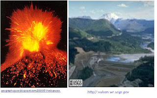
Back at the east coast in Kunak, around 30,000 BC, Mount Mostyn erupted. The lava flow blocked part of the Tingkayu River forming a lake.  Many years after the molten rock cooled down, the bank of the lake and its surrounding became so fertile and flourished with tropical plants. Soon, bountiful animals congregated to the site to forage young shoots and slurp on the crystal clear water of the lake. It became a first-class hunting ground.


 Note: Many of the images shown here are for illustrations only. The source is shown under the respective image.

A group of people who by many generations had travelled though continents by the “land bridges” finally arrived at the spot.  They looked around and saw some limestone caves. They must had been tired and hungry and decided to make those caves their home. After a while, the women and the children went out gathering berries and fruits for lunch. With the lush flora in their surrounding, it did not take them very long to come back with full pelts.

Meanwhile the men put up fire, gathered some flat hard stones and started to pound on them. They were making tools for hunting.